Ukraine maps for pygal

Project description
pygal_maps_ua
Ukraine maps for pygal
Ukraine map plugin for Pygal
Allows you to create first level division administrative map of Ukraine
At the first level Ukraine is divided into 27 regions: 24 oblasts (regions), 1 autonomous republic (Crimea) and 2 cities with special status (Kyiv, Sevastopol)
Install
pip install pygal_maps_ua
Usage
This package is a plugin for an open-source data visualization library Pygal, so please refer the Pygal and Pygal / Chart types / Maps documentation for deeper understanding of the code below
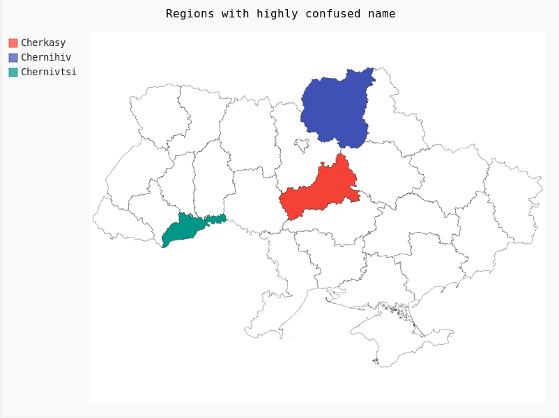
from pygal.maps.ua import Regions

map = Regions()
map.title = 'Regions with highly confused name'
map.add('Cherkasy', ['cherkasy'])
map.add('Сhernihiv', ['chernihiv'])
map.add('Сhernivtsi', ['chernivtsi'])

map.render_to_png('chart.png')
Result:
You can also specify a value for the region
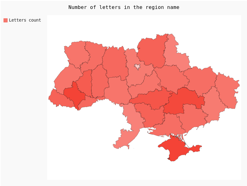
from pygal_maps_ua.maps import Regions, REGIONS_UA

map = Regions()
map.title = 'Number of letters in the region name'
map.add(
    "Letters count",
    {x: len(y) for x, y in REGIONS_UA.items()}
)

map.render_to_png('chart.png')
Result:
Temporarily occupied territories
It is possible to render a map with the schematic visualization of temporarily occupied territories of Donetsk and Luhansk regions (known as ORDLO). This area refers to territories occupied by Russia in the 2014 year) and don't refer to territories, occupied by Russia during full-scale Russian invasion of Ukraine in 2022
You can use such a template by calling the RegionsOrdlo class and refer the occupied regions area and ordlo key respectively
from pygal.maps.ua import RegionsOrdlo

map = RegionsOrdlo()
⚠ Warning
It should be a valid reason to use such a map template instead of Regions template
The straight use-case is to visualize some statistical data from 2014 and clearly display that you have no data from the temporarily occupied territories
It is strictly forbidden to use this map template to dispute in any way the sovereignty and territorial integrity of Ukraine (including marking occupied territories as "disputed", "unrecognised", "self-proclaimed" or using any other formulations except "occupied" or "temporarily occupied" according to the UN resolutions 73/194, ES-11/4 and common sense).
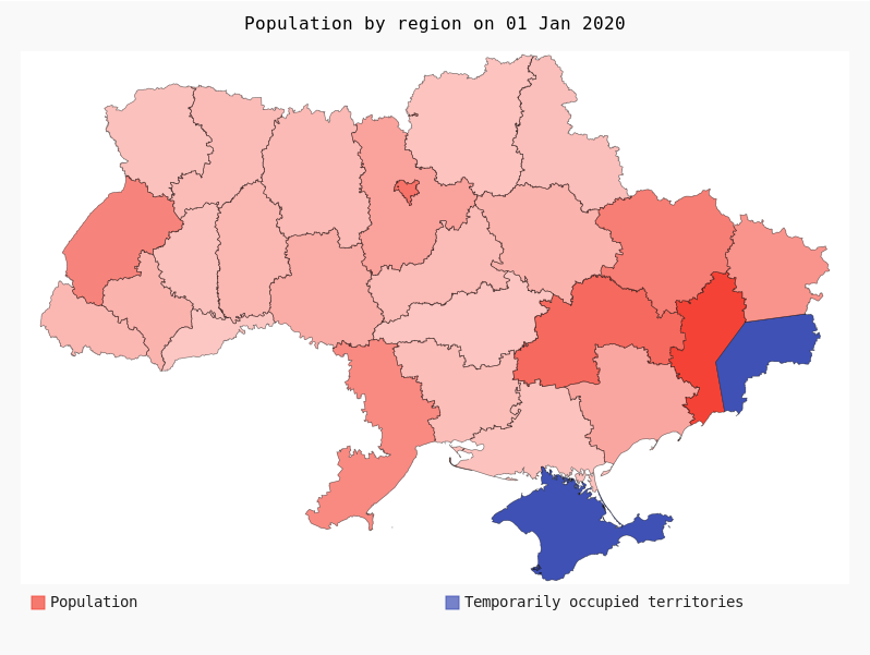
The example of using the RegionsOrdlo for the use-case of visualizing the population of Ukraine on 1 Jan 2020 is provided below:
from pygal.maps.ua import RegionsOrdlo

population_2020_by_region = {
    "vinnytsia" :1545416,
    "volyn" :1031421,
    "dnipropetrovsk" :3176648,
    "donetsk" :4131808,
    "zhytomir" :1208212,
    "zakarpattia" :1253791,
    "zaporizhzhia" :1687401,
    "ivano-frankivsk" :1368097,
    "kyiv" :1781044,
    "kirovohrad" :933109,
    "luhansk" :2135913,
    "lviv" :2512084,
    "mykolaiv" :1119862,
    "odesa" :2377230,
    "poltava" :1386978,
    "rivne" :1152961,
    "sumy" :1068247,
    "ternopil" :1038695,
    "kharkiv" :2658461,
    "kherson" :1027913,
    "khmelnitskyi" :1254702,
    "cherkasy" :1192137,
    "chernivtsi" :901632,
    "chernihiv" :991294,
    "kyivcity" :2967360,
}


map = RegionsOrdlo(legend_at_bottom=True)

map.title = 'Population by region on 01 Jan 2020'
map.add('Population', population_2020_by_region)
map.add('Temporarily occupied territories', ['ordlo', 'crimea', 'sevastopolcity'])

map.render_to_png('chart.png')
Result:
List of available regions
List of available regions is set as variables REGIONS_UA and REGIONS_ENG respectively and listed below:
| key | description [ua] | description [en] |
|---|---|---|
| cherkasy | Черкаська область | Cherkasy Oblast |
| chernihiv | Чернігівська область | Chernihiv Oblast |
| chernivtsi | Чернівецька область | Chernivtsi Oblast |
| crimea | Автономна Республіка Крим | Autonomous Republic of Crimea |
| dnipropetrovsk | Дніпропетровська область | Dnipropetrovsk Oblast |
| donetsk | Донецька область | Donetsk Oblast |
| ivano-frankivsk | Івано-Франківська область | Ivano-Frankivsk Oblast |
| kharkiv | Харківська область | Kharkiv Oblast |
| kherson | Херсонська область | Kherson Oblast |
| khmelnitskyi | Хмельницька область | Khmelnytskyi Oblast |
| kyiv | Київська область | Kyiv Oblast |
| kyivcity | Київ | Kyiv |
| kirovohrad | Кіровоградська область | Kirovohrad Oblast |
| lviv | Львівська область | Lviv Oblast |
| luhansk | Луганська область | Luhansk Oblast |
| mykolaiv | Миколаївська область | Mykolaiv Oblast |
| odesa | Одеська область | Odesa Oblast |
| poltava | Полтавська область | Poltava Oblast |
| rivne | Рівненська область | Rivne Oblast |
| sevastopolcity | Севастополь | Sevastopol |
| sumy | Сумська область | Sumy Oblast |
| ternopil | Тернопільська область | Ternopil Oblast |
| vinnytsia | Вінницька область | Vinnytsia Oblast |
| volyn | Волинська область | Volyn Oblast |
| zakarpattia | Закарпатська область | Zakarpattia Oblast |
| zaporizhzhia | Запорізька область | Zaporizhzhia Oblast |
| zhytomir | Житомирська область | Zhytomyr Oblast |
If you need to update the region names for your purposes (e.g. use only city names), use the set_regions or set_regions_eng functions
If you would like to support the author consider donating to the United24 charity foundation
Data Source for Ukraine ADM1 borders:
Hijmans, Robert J.. University of California, Berkeley. Museum of Vertebrate Zoology. First-level Administrative Divisions, Ukraine, 2015. [Shapefile]. University of California, Berkeley. Museum of Vertebrate Zoology. Retrieved from https://maps.princeton.edu/catalog/stanford-gg870xt4706
Release history Release notifications | RSS feed

Download files
Download the file for your platform. If you're not sure which to choose, learn more about installing packages.
Source Distribution
Built Distribution
Hashes for pygal_maps_ua-1.0.2-py3-none-any.whl
| Algorithm | Hash digest | |
|---|---|---|
| SHA256 | 2303e86da759d46512fa1b6edd8e6fedbd6b9662f723bd0030886efc27999b03 |
|
| MD5 | d633f50f56e06eaad24eb401fa52670b |
|
| BLAKE2b-256 | a3de7a096a198142c38dec436e830d207a88ad2c69ab8be11a81b5456f0bf590 |


